


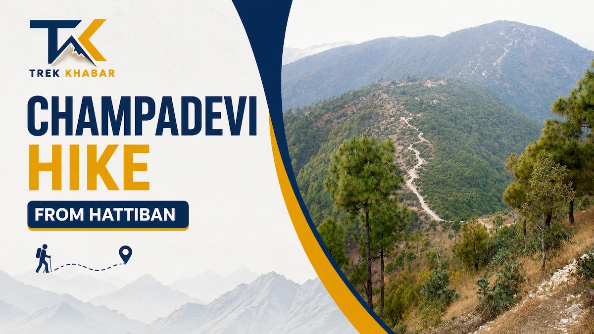
The Champadevi Hike from Hattiban is one of the best short hiking routes around Kathmandu for anyone who wants forest trails, ridge walking, mountain views, religious sites, and a genuine outdoor experience without committing to a multi-day trek.
Starting from the Hattiban area, the trail climbs through pine, oak and rhododendron forest toward the summit of Champadevi, a sacred hill on the southern rim of Kathmandu Valley. The route is moderately challenging rather than technically difficult, making it suitable for regular walkers, beginners with reasonable fitness, families with older children, and experienced hikers looking for a quick morning adventure.
The summit area combines a Champadevi shrine, Buddhist prayer flags and a nearby stupa with broad views across Kathmandu Valley. On a clear day, the surrounding Himalayan skyline can add another dimension to the hike.
The main trail is represented on maps as Hattiban-champadevi Hiking trail (deurali), while Champadevi marks the summit area.
Champadevi Hike From Hattiban at a Glance
| Category | Details |
|---|---|
| Destination | Champadevi Hill |
| Starting point | Hattiban, near Pharping |
| Elevation | Approximately 2,278 m |
| Approx. elevation gain from Hattiban | Around 600 m |
| Hiking difficulty | Moderate |
| Round-trip walking time | Around 3–4 hours |
| Full excursion from Kathmandu | Around 5–7 hours |
| Trail type | Forest, stone steps, dirt trail and ridge |
| Technical climbing | None |
| Best seasons | Autumn, winter and spring |
| Main attractions | Forest, ridge, shrine, stupa, Kathmandu Valley views and Himalayan panorama |
| Recommended start | Early morning |
| Accommodation required | No |
| Guide required | Not normally for experienced local hikers |
| Water availability | Carry your own |
| Route type | Out-and-back, with several alternative exits |
Elevation figures for Champadevi vary slightly between published hiking sources, with approximately 2,278 m being a commonly cited figure. Some operators list slightly different elevations because of differences in mapping and summit points.
Where Is Champadevi?
Champadevi lies on the southern rim of Kathmandu Valley, above the Hattiban and Pharping area. Geographically, it sits between the urban Kathmandu Valley and the greener hills toward Pharping and Dakshinkali.
Its location is one of the major reasons the hike is so popular. You can leave Kathmandu in the morning, reach the trailhead relatively quickly and spend several hours walking through forest without needing to travel deep into the mountains.
The area around the trail is also connected with several other hiking corridors, including routes toward Kirtipur, Dollu, Machhegaun, Bhasmasur and the Chandragiri ridge.
Why Hike Champadevi From Hattiban?
There are several ways to reach Champadevi, but Hattiban is one of the most practical starting points for a dedicated Champadevi day hike.
The biggest advantage is the balance between effort and reward. You gain substantial elevation without needing to spend an entire day walking from the valley floor.
The trail also provides a changing landscape. The lower section around Hattiban leads into forest, while higher sections become more open and eventually reach the ridge and summit area.
Another advantage is flexibility. You can return to Hattiban after reaching the summit, or turn the hike into a longer point-to-point adventure by choosing an alternative descent.
How to Get to Hattiban From Kathmandu
The easiest way to reach Hattiban is by private vehicle or taxi.
From central Kathmandu, travel south toward the Pharping area and continue toward Hattiban. Depending on traffic and your exact starting location, the drive can commonly take around 45–60 minutes.
If you are using public transportation, you can travel toward Pharping and then arrange local transport or walk toward the Hattiban area. The exact public transport options can change, so it is worth checking the route on the day of your hike.
For a first-time visitor, a taxi or private vehicle is generally the simplest option because it removes uncertainty about the final approach to the trailhead.
The Hattiban area has several mapped hiking access points, so it is better to confirm the exact trailhead with your driver rather than simply saying “Champadevi.”
Hattiban to Champadevi Route
The standard Hattiban route is straightforward: start around Hattiban, enter the forest trail, continue uphill toward the Champadevi ridge and follow the ridge toward the summit shrine.
Hattiban to Champadevi trek starting point. is one of the mapped starting areas for this hike.
The trail is generally easy to recognize because it is regularly used by local walkers and hikers. However, small side trails can appear in forested sections, particularly where local paths branch toward villages and other ridges.
A hiking app with an offline map is therefore useful, particularly if you plan to take one of the alternative exits rather than returning to Hattiban.
Stage 1: Hattiban Trailhead to the Forest
The hike begins around Hattiban, where the surroundings gradually transition from developed areas into woodland.
The initial section is relatively comfortable compared with the steeper portions higher up. Once inside the forest, the urban noise begins to disappear and the character of the hike changes.
Depending on the season, you may see pine, oak, rhododendron and other vegetation typical of the hills surrounding Kathmandu Valley. The forest is one of the attractions of this route rather than simply a means of reaching the summit. If the sky is clear you’ll see Fulchwoki from distance.
Check Phulchwoki Hike guide to add it to your bucket list
Take this section slowly. It is tempting to push hard at the beginning, but maintaining a consistent pace is much more comfortable because the route continues climbing for a considerable distance.
Stage 2: Climbing Through the Forest
After entering the forest, the trail gradually becomes more demanding.
Some sections consist of uneven natural ground, while others use stone steps or established paths. There are several uphill stretches where the gradient becomes noticeably steeper.
This is the main physical challenge of the Hattiban route.
There is no technical climbing and generally no serious exposure, but the continuous ascent can make the hike feel harder than its relatively short distance suggests.
For beginners, the best strategy is to maintain a conversational pace rather than trying to reach the summit quickly.
Stage 3: Reaching the Champadevi Ridge
As you gain elevation, the forest begins to open in places and the trail approaches the ridge.
This section is particularly enjoyable because you start getting more expansive views rather than seeing only trees.
The southern Kathmandu Valley, Pharping area and surrounding hills gradually become visible.
On clear mornings, the combination of green forest, distant hills and the Kathmandu Valley creates some of the best scenery available on a short hike close to the capital.
Stage 4: The Final Ascent to Champadevi
The final section continues uphill toward the summit area.
The trail can contain steeper and uneven sections, particularly close to the top, but it does not normally require scrambling or technical climbing.
Once the trail reaches the summit area, the character changes again.
Prayer flags, the Champadevi shrine and the open ridge immediately make it clear that you have reached a culturally significant location rather than simply a viewpoint.
Champadevi Summit
The summit of Champadevi is both a hiking destination and a religious site.
A shrine dedicated to Champadevi is located in the summit area, while Buddhist elements including prayer flags and a stupa reflect the area’s wider spiritual importance.
The summit is not simply a place to take photographs and immediately descend.
Spend some time here.
Walk carefully around the summit area, enjoy the scenery, respect religious structures and avoid disturbing offerings or prayer flags.
The open sections of the ridge provide excellent opportunities for photography, particularly during clear mornings.
What Can You See From Champadevi?
The views are one of the main reasons people choose this hike.
From the summit, you can look across large portions of Kathmandu Valley and toward surrounding hills.
Depending on visibility, commonly mentioned mountain views include:
- Langtang range
- Ganesh Himal
- Dorje Lakpa
- Gaurishankar
- Other Himalayan peaks visible along the northern horizon
Different mountains become visible depending on weather, atmospheric pollution and the exact viewing direction.
Do not expect guaranteed Himalayan views every time you visit.
A clear autumn or winter morning is much more likely to provide a distant mountain panorama than a hazy afternoon in the warmer months.
Champadevi Hike Distance and Time
There is no single universally applicable distance for the Champadevi hike because several trailheads and exits exist.
For the standard Hattiban route, a reasonable expectation is approximately:
3–4 hours for the round trip from Hattiban.
Some hiking operators allow closer to five hours depending on walking pace, stops and the exact starting point.
A realistic schedule for an average hiker would be:
| Section | Approx. time |
| Hattiban to forest trail | 20–30 min |
| Forest ascent | 60–90 min |
| Final climb to summit | 30–45 min |
| Summit/rest/photos | 20–45 min |
| Descent to Hattiban | 60–90 min |
| Total walking | 3–4+ hours |
If you are a beginner, have children with you, or want plenty of time for photography, plan for more than the minimum estimate.
Champadevi Hike Difficulty
The Hattiban to Champadevi hike is best described as moderate.
It is not a technical trek, but it is not completely effortless either.
The primary challenge is sustained elevation gain.
You will repeatedly climb uphill, and some sections are steep enough to raise your heart rate considerably. The trail can also become slippery or muddy after rain.
There is generally no climbing equipment required and no major exposed section on the standard Hattiban route.
Suitable for beginners?
Yes.
A reasonably active beginner can complete the hike by maintaining a slow pace and taking breaks.
If you rarely walk uphill, however, do not judge the hike by its short distance. The elevation gain is what makes the route physically demanding.
Best Time to Hike Champadevi
The best overall periods are autumn, winter and spring.
Autumn
October and November are particularly attractive because the weather is often clearer after the monsoon.
The forest remains relatively fresh, while the chances of seeing distant mountains are generally much better than during the rainy season.
Winter
December through February can provide exceptionally clear mountain views.
Start early because winter mornings can be cold, especially before the sun reaches the forest.
Spring
March and April are excellent for vegetation and rhododendron blooms.
The forest becomes more colorful, making spring an especially good season for photographers and nature lovers.
Monsoon
June through September is the least convenient period.
Rain can make stone steps, roots and dirt sections slippery. Clouds can also hide the mountains and reduce visibility.
You can still hike Champadevi during periods of stable weather, but check conditions before leaving.
Best Time of Day for Champadevi Hike
Early morning is the best choice.
A morning start gives you cooler temperatures and usually better visibility.
It also gives you enough time to complete the hike without rushing.
For photographers, early morning can provide softer light and better atmospheric conditions.
An early start is particularly useful if you plan to extend the route toward another exit such as Machhegaun or continue along the southern ridge.
Alternative Champadevi Hiking Routes
One of the biggest strengths of Champadevi is that it is not limited to a single trail.
Depending on your fitness, available time and transport arrangements, you can turn the hike into a short round trip, a longer traverse or a point-to-point hike.
1. Hattiban to Champadevi and Back
Best for: First-time hikers, families and short day hikes.
This is the simplest option.
Start at Hattiban, climb to Champadevi, spend time at the summit and return along the same trail.
Approximate walking time
3–4 hours
Why choose it?
- Simple navigation
- Easy return logistics
- No need to arrange a pickup elsewhere
- Moderate difficulty
- Good for beginners
- Easy to fit into a half-day
This is the route I would recommend if your primary goal is simply to experience Champadevi.
2. Pharping to Hattiban to Champadevi
Best for: Hikers who want a longer and more complete approach.
Instead of starting directly at Hattiban, begin lower around Pharping and walk toward Hattiban before continuing to Champadevi.
This adds another layer to the hike and allows you to experience more of the southern valley landscape.
The Pharping-to-Champadevi approach can take roughly 2.5–3.5 hours one way depending on the exact trail and pace.
The total outing can therefore become a substantial full-day hike.
3. Champadevi to Machhegaun Exit
Best for: Hikers who dislike returning on the same trail.
After reaching Champadevi, instead of descending all the way back to Hattiban, you can continue along the ridge and descend toward Machhegaun.
This creates a point-to-point experience rather than an out-and-back hike.
The Machhegaun option is particularly useful if you have arranged a vehicle to meet you there. Route descriptions also identify Machhegaun as an alternative exit from the broader Champadevi/Bhasmasur ridge system.
Advantages
- More varied scenery
- Less repetition
- Village and farmland landscapes
- Good option for experienced hikers
Important
Do not choose this exit without checking your navigation route first.
Transport availability at the finishing point can also be less predictable than at Hattiban.
4. Champadevi to Kirtipur Exit
Best for: Hikers interested in combining nature with Newari culture.
Another option is to descend toward Kirtipur.
This turns your hiking day into a combination of forest hiking and cultural exploration.
Kirtipur is one of the historic settlements of Kathmandu Valley, so this option is particularly attractive if you want something beyond a simple hill climb.
One published route description identifies a trail from the Champadevi summit toward Kirtipur, followed by a short exploration of the historic town.
You can finish the hike in Kirtipur and return to Kathmandu by road.
5. Champadevi to Dollu Exit
Best for: Hikers looking for a quieter alternative.
Dollu provides another possible descent from the Champadevi area.
The Hattiban–Champadevi trail network connects with quieter trails toward the Dollu side, making it possible to design a point-to-point hike rather than simply retracing your steps.
This is better suited to hikers who are comfortable with offline maps and route navigation.
6. Champadevi and Bhasmasur Route
Best for: Stronger hikers wanting more elevation and a longer ridge walk.
Champadevi does not have to be the final destination.
You can extend the adventure toward Bhasmasur, creating a longer southern-ridge hike.
The Bhasmasur–Champadevi area contains narrower and less crowded forest sections, making the extension feel considerably more adventurous than the standard Hattiban round trip.
Because this is longer and more complicated, carry sufficient water, start early and use reliable navigation.
7. Champadevi via Chandragiri
Best for: Experienced hikers who want a long ridge adventure.
This is one of the most ambitious ways to combine the southern Kathmandu Valley hills.
A common variation begins at Chandragiri, where hikers can use the cable car to reach Chandragiri Hill and then continue on foot toward Bhasmasur and Champadevi. From Champadevi, the route can descend toward Hattiban.
The walking portion can take approximately 4–5 hours, depending on the exact route and pace.
This should not be treated like the standard Hattiban hike.
It requires more time, better navigation and considerably more stamina.
8. Bosan Danda Route
Bosan Danda is another approach used by local hikers.
It can provide a quieter alternative to the more established Hattiban approach and can be incorporated into a longer southern valley ridge itinerary.
Because trail conditions and junctions can vary, this is better for people using GPS/offline maps or hiking with someone familiar with the area.
Best Champadevi Route by Hiker Type
| Hiker | Recommended route |
| First-time visitor | Hattiban → Champadevi → Hattiban |
| Beginner | Hattiban round trip |
| Family | Hattiban round trip |
| Photographer | Early-morning Hattiban route |
| Strong hiker | Pharping → Hattiban → Champadevi |
| Point-to-point fan | Champadevi → Machhegaun |
| Culture lover | Champadevi → Kirtipur |
| Experienced trekker | Champadevi → Bhasmasur |
| Ridge enthusiast | Chandragiri → Bhasmasur → Champadevi |
| Quiet-trail seeker | Dollu/Bosan Danda variations |
Champadevi Exit Routes: Which One Should You Choose?
If you are specifically looking for alternative exits, this is the most practical way to think about them.
Exit 1: Return to Hattiban
Easiest logistics
Choose this when you have a vehicle waiting at Hattiban or simply want a straightforward hike.
Exit 2: Machhegaun
Best point-to-point option
Choose this when you want to avoid walking the same trail twice.
Exit 3: Kirtipur
Best cultural option
Finish the hike near Kirtipur and combine the walk with a visit to the historic city.
Exit 4: Dollu
Best quieter descent
Useful for hikers who want to explore another side of the ridge.
Exit 5: Taudaha side
Some longer southern ridge itineraries can descend toward Taudaha or connect with trails closer to Kirtipur. These should be treated as navigation-dependent routes rather than assuming there is one clearly marked standard trail.
What Makes Champadevi Different From Other Kathmandu Hikes?
Kathmandu has many popular day hikes, but Champadevi occupies a useful middle ground.
Chandragiri offers a higher summit and cable-car access, while Shivapuri provides a larger forested hiking environment. Champadevi, meanwhile, provides a comparatively compact combination of forest, ridge, religious heritage and valley views.
It is also significantly more flexible than many short hikes because you can approach it from multiple sides and create different starting and finishing points.
That makes Champadevi particularly useful for repeat hikers.
Your first visit can be a simple Hattiban round trip. A later visit can become a Pharping–Champadevi traverse, a Kirtipur descent or a longer Bhasmasur ridge adventure.
Champadevi Hike Itinerary From Hattiban
Here is a practical one-day itinerary.
6:30 AM – Leave Kathmandu
Start early to avoid traffic and reach Hattiban while temperatures are comfortable.
7:30–8:00 AM – Arrive at Hattiban
Prepare your backpack, drink some water and begin the hike.
8:00–9:30 AM – Forest ascent
Walk steadily through the forest.
Avoid using all your energy during the first steep sections.
9:30–10:30 AM – Final climb
Continue toward the ridge and summit.
Take short breaks whenever necessary.
10:30 AM – Champadevi Summit
Spend time at the shrine and viewpoint.
Take photographs, eat a snack and enjoy the valley and mountain scenery if visibility is good.
11:00 AM – Begin descent
Return toward Hattiban using the standard trail.
12:30–1:30 PM – Arrive at Hattiban
Depending on your pace, the round trip can be completed around this time.
Afternoon – Optional extension
If you still have time, you can combine the outing with nearby attractions around Pharping, Taudaha or Kirtipur.
What to Pack for Champadevi Hike
You do not need expedition-level equipment for Champadevi.
However, basic preparation makes the hike much more comfortable.
Essential items
- Comfortable hiking shoes
- 1.5–2 litres of drinking water
- Light snacks
- Phone
- Power bank
- Sunglasses
- Sunscreen
- Light rain jacket
- Small first-aid kit
- Offline trail map
- Hat or cap
- Light warm layer during winter
For longer routes such as Chandragiri–Bhasmasur–Champadevi, carry more water and food.
What Shoes Should You Wear?
Good walking or hiking shoes are preferable.
The trail is not technical, but uneven stones, roots, loose soil and wet sections can occur.
During the dry season, normal trail shoes may be sufficient.
During or after rainfall, shoes with good grip become much more important.
Avoid completely smooth-soled casual shoes if you are unfamiliar with uphill hiking.
Is There Food and Water on the Champadevi Trail?
Do not rely on finding regular food and water services along the ridge.
The safest approach is to leave Hattiban with enough water and snacks for the entire hike.
For a standard round trip, around 1.5–2 litres of water per person is a sensible starting point, with more required in hot weather or for longer routes.
You can eat before or after the hike around Hattiban, Pharping or Kathmandu rather than depending on facilities at the summit.
Mobile Network and Navigation
Mobile connectivity can vary through the forest.
Even if your phone has a signal, do not assume that every trail junction will be obvious.
For the standard Hattiban route, the trail is commonly used and generally straightforward.
Alternative exits are different.
If you plan to descend toward Machhegaun, Dollu, Kirtipur, Taudaha or another location, download an offline map before leaving.
This is particularly important because the Champadevi area contains a network of local paths rather than one single trail.
Is a Guide Necessary for Champadevi?
For the standard Hattiban–Champadevi–Hattiban hike, a guide is not normally necessary for an experienced local hiker.
The route is relatively popular and well used.
However, a guide can still be useful if:
- You are visiting Nepal for the first time
- You do not speak Nepali
- You want cultural interpretation
- You are hiking with children
- You plan a longer point-to-point route
- You want to combine Champadevi with Bhasmasur or Chandragiri
- You are uncomfortable navigating forest trails
The need for a guide increases significantly once you move away from the standard route.
Is Champadevi Hike Safe?
The standard route is generally considered a manageable day hike, but normal mountain safety precautions still apply.
The biggest practical hazards are not technical climbing or exposure.
They are:
- Slippery trails
- Dehydration
- Heat
- Getting lost on alternative trails
- Sudden weather changes
- Fatigue
- Hiking after dark
Start early, carry sufficient water and avoid taking unfamiliar shortcuts.
If the trail is wet, slow down rather than trying to maintain your dry-season pace.
Photography Tips for Champadevi
For the best photographs, start early.
Morning light is generally more flattering than harsh midday sunlight.
At the summit, photograph in several directions rather than taking only a single north-facing mountain shot.
Some of the best photographs can actually be taken before reaching the summit, where the forest trail opens toward the valley.
Useful subjects include:
- Prayer flags
- Champadevi shrine
- Forest trail
- Ridge landscapes
- Kathmandu Valley
- Pharping
- Distant mountains
- Local villages
- Spring vegetation
Remember to photograph religious sites respectfully.
Champadevi for Beginners
Champadevi is a good introduction to hiking around Kathmandu.
It provides enough elevation gain to feel like a real hill hike while avoiding the logistical complexity of a multi-day trek.
If you are a complete beginner, do not focus on speed.
Walk slowly.
Take short breaks.
Drink regularly.
Most importantly, do not compare your hiking pace with people who regularly hike the Kathmandu hills.
A comfortable three-and-a-half-hour hike is much better than trying to finish in two hours and exhausting yourself.
Champadevi Hike for Families
Families can consider the Hattiban route if children are accustomed to walking uphill.
The standard out-and-back route is preferable to a longer point-to-point itinerary because you can turn around whenever necessary.
For younger children, start early and bring enough snacks and water.
Do not choose the Chandragiri–Bhasmasur extension simply because the children completed the standard hike comfortably. The longer route introduces considerably more walking and route-finding.
Champadevi Hike Cost
One of the biggest advantages of Champadevi is its low overall cost.
There is normally no need for expensive trekking infrastructure.
Your major expenses are likely to be:
- Transportation to Hattiban
- Food and drinks
- Optional guide
- Optional additional sightseeing
If you already live in Kathmandu and use local transportation, Champadevi can be one of the most affordable hiking destinations near the city.
Things to Do Around Champadevi After the Hike
You can turn the hike into a full southern Kathmandu outing.
Depending on your route, consider combining it with:
Pharping
Pharping is known for its religious and cultural significance and can make a natural extension to a Champadevi day.
Taudaha Lake
Taudaha is another popular stop around the southern edge of Kathmandu Valley and can be incorporated into a route returning toward the city. Some Champadevi itineraries specifically recommend visiting Taudaha after the hike.
Kirtipur
If you choose the Kirtipur exit, you can explore historic Newari architecture, temples and traditional streets after completing the hike.
Dakshinkali Area
The southern Kathmandu region contains several culturally significant destinations, making it possible to combine hiking with sightseeing.
Responsible Hiking at Champadevi
Champadevi is both a natural environment and a religious landscape.
Hikers should therefore treat the trail and summit respectfully.
Do not leave plastic bottles or food packaging behind.
Avoid loud music.
Do not damage plants.
Do not climb onto religious structures for photographs.
Do not touch offerings unnecessarily.
If you carry snacks, bring your waste back with you.
A short hike becomes much more enjoyable when the trail remains clean for the local community and future hikers.
Common Mistakes to Avoid
Starting too late
A late start means hotter conditions, poorer visibility and less time for alternative routes.
Carrying too little water
There may not be reliable water sources where you need them.
Wearing unsuitable shoes
Smooth-soled casual shoes can become uncomfortable or slippery.
Assuming every trail junction leads to Hattiban
The wider Champadevi area has multiple trails.
Choosing an alternative exit without transport planning
Finishing at Machhegaun or another village is useful only if you know how you will return to Kathmandu.
Ignoring weather
Clear skies in Kathmandu do not guarantee equally clear conditions on the ridge.
Rushing the summit
The hike is short enough that there is little reason to race.
Champadevi Hike vs Chandragiri Hike
| Feature | Champadevi | Chandragiri |
| Difficulty | Moderate | Moderate to challenging depending on route |
| Main attraction | Forest + ridge + shrine | High summit + cable car + views |
| Elevation | ~2,278 m | ~2,550 m |
| Cable car | No | Yes |
| Typical experience | Quieter natural hike | More developed tourist destination |
| Alternative trails | Many | Many |
| Cultural interest | High | High |
| Good for beginners | Yes | Yes, especially with cable car |
| Point-to-point potential | Excellent | Excellent |
Champadevi is particularly attractive if you want a more traditional forest hike without relying on a cable car.
Frequently Asked Questions
How long is the Champadevi hike from Hattiban?
The standard Hattiban–Champadevi–Hattiban route generally takes around 3–4 hours of walking, although slower hikers and people taking longer summit breaks should allow additional time.
How difficult is Champadevi hike from Hattiban?
It is a moderate hike. The main challenge is continuous uphill walking and elevation gain rather than technical terrain. There is generally no technical climbing or serious exposure on the standard route.
What is the elevation of Champadevi?
Champadevi is commonly listed at approximately 2,278 metres above sea level, although different sources and operators give slightly different figures.
Where does the Champadevi hike from Hattiban start?
The hike begins around the Hattiban area on the southern side of Kathmandu Valley, near Pharping. There are several mapped trail access points around Hattiban, so confirming the exact trailhead before starting is recommended.
Can beginners do the Champadevi hike?
Yes. Beginners with reasonable fitness can complete the standard Hattiban route. The key is to maintain a steady pace and take sufficient breaks.
Is Champadevi suitable for children?
Older children who are comfortable with uphill walking can generally do the standard Hattiban route. Families should avoid assuming that longer ridge extensions will be equally suitable.
Can I hike Champadevi without a guide?
Yes. The standard Hattiban route is commonly used and is relatively straightforward. A guide becomes more useful for alternative exits and longer routes.
Is Champadevi open throughout the year?
The trail can generally be visited throughout the year, but weather strongly affects trail conditions and views. Monsoon is the least convenient period because of rain and slippery surfaces.
What is the best month to hike Champadevi?
October, November, December, January, February, March and April are generally favorable periods, with autumn and clear winter mornings particularly attractive for mountain views.
Can I see Mount Everest from Champadevi?
Distant Himalayan peaks can be visible from Champadevi in clear conditions, and some descriptions mention Everest among possible distant views. However, visibility varies considerably, so Everest should never be treated as a guaranteed view.
Can I go from Champadevi to Kirtipur?
Yes. A descent toward Kirtipur is one of the alternative point-to-point options associated with the Champadevi trail network.
Can I go from Champadevi to Machhegaun?
Yes. Machhegaun can be used as an alternative exit on longer Champadevi ridge itineraries.
Can Champadevi be combined with Bhasmasur?
Yes. Stronger hikers can extend the route toward Bhasmasur, creating a longer ridge hike. This requires more time, water and navigation preparation.
Can I combine Champadevi with Chandragiri?
Yes. One of the longer variations uses Chandragiri as the starting point, continues toward Bhasmasur and then reaches Champadevi before descending toward Hattiban. The walking section is commonly estimated at around 4–5 hours depending on the exact route.
Is there accommodation at Champadevi?
You do not need accommodation for the standard hike. Champadevi is normally visited as a day hike from Kathmandu.
Should I carry food?
Yes. Carry snacks and sufficient water, particularly if you plan to extend the hike beyond the standard Hattiban round trip.
Is Champadevi better in the morning or afternoon?
Morning is preferable because temperatures are cooler and visibility is often better. An early start also gives you more flexibility if you decide to extend the hike.
Is Champadevi worth visiting?
Yes, especially if you want a relatively short Kathmandu Valley hike that combines forest, elevation, ridge walking, religious heritage and panoramic scenery without requiring a multi-day trek.
Final Verdict: Is the Hattiban to Champadevi Hike Worth It?
The Champadevi Hike from Hattiban is one of the strongest choices for a short adventure around Kathmandu.
It does not require the logistics of a Himalayan trek, but it still gives you the feeling of leaving the city behind. The forested ascent, ridge walking, summit shrine, prayer flags and potential Himalayan views make the route considerably more rewarding than a simple uphill walk.
For first-time visitors, the Hattiban → Champadevi → Hattiban route is the safest and simplest choice.
For hikers who want something more adventurous, the real attraction is the wider trail network. You can extend toward Machhegaun, Kirtipur, Dollu, Bhasmasur or even Chandragiri, transforming the same destination into a much longer point-to-point adventure.
If you only have half a day, hike Hattiban to Champadevi and return.
If you have a full day, consider a point-to-point route.
And if you are an experienced hiker looking for a bigger challenge around Kathmandu Valley, use Champadevi as one section of a longer southern-ridge traverse.
References
