


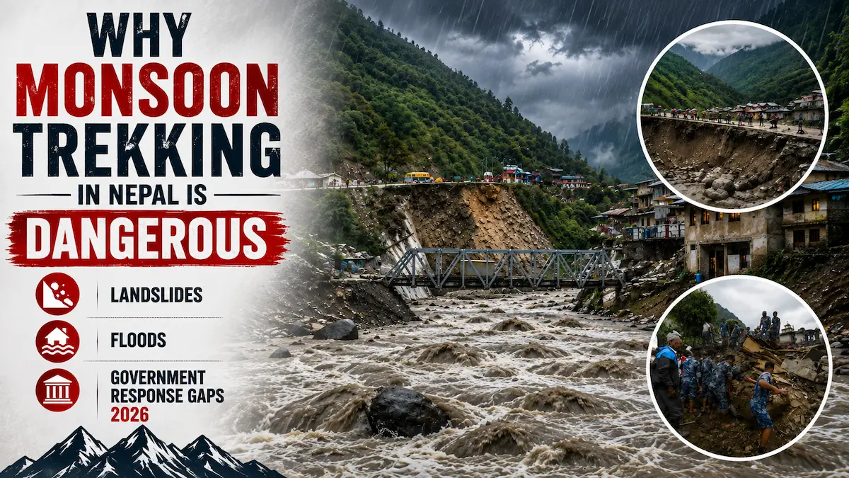
Why Avoid Monsoon Trekking?
The facts: The monsoon (June-August) season is really risky for trekking in Nepal. Beware of going on treks here in the monsoon season and having a normal trek. You’ll get:
- Trails blocked by landslides (frequent)
- The frequency of the potential is: Regular occurrence: ✗ Flash floods destroying bridges and paths.
- Mountain views hidden by clouds (constant)
- Unstable weather (unpredictable)
- Limited rescue options (government capacity is stretched)
- The evacuation is not reliable (slow response time)
- The weather is extremely rough and turbulent, and the majority of businesses are closed.
For the same 30-40% savings (which may be cheaper), there is no justification for the risks.
It’s been years since I’ve seen monsoon cause:
- Many fatalities reported from landslides. Several casualties were reported due to landslides.
- Groups that were stranded by washed trails.Groups that were stranded due to washed trails.
- Medical emergencies (including delayed evacuation = 24-48 hours)
- Loss of route connections (wasting valuable time and money)
- Severe injuries due to falls on muddy trails
- Cold stress associated with exposure to weather conditions resulting in hypothermia.Hypothermia from weather exposure.
What is a monsoon in Nepal?
Understanding the monsoon is understanding why it’s dangerous.
Timing: June 1 – August 31 (technically May 15 – September 15, but June-August is peak)
What happens: The Southwest Monsoon brings moisture-laden winds from the Bay of Bengal across India and into Nepal. These winds dump enormous quantities of rain on Nepal’s mountains.
Rainfall intensity:
In Nepal, the monsoon season accounts for about 80% of the annual rainfall. Some areas get more rain in a day than others get in a year.
Real data:
- The average annual precipitation for Kathmandu is 1,400mm, with between 400-500mm during the monsoon (June-August).
- In Pokhara, the annual rainfall is 4,400mm, typically 1,200- 1,500 mm during the monsoon season.
- Higher elevations: Far more spectacular (rainfall is enhanced in mountain areas)
This is not a normal rain. This is a continuous and heavy downpour for three months in a row.
Daily rainfall during peak monsoon:
- July, August: 10-15 rainy days monthly
- August: 16-19 rainy days monthly
- September: 15-20 rainy days monthly
“Rainy days” refers to occasions of heavy precipitation, not to rain or drizzle. 50 – 150 mm of rain is received over many days in 24 hours.
Impact on terrain:
Predictable consequences: Mountainous terrain + extreme rainfall = Mountainous terrain + extreme rainfall.
- The stability of a saturated soil is lost.
- The stable slopes turn into hazards. The once-stable slopes turn into hazards.
- Flows of water are accelerated in the small streams
- Bridges are washed away.
- Trails become rivers
This isn’t theory. This is what literally happens every monsoon.
The Landslide Crisis During Monsoon
Landslides are the primary danger on monsoon treks. Understanding them is understanding the core risk.
Why landslides happen:
- Saturated soil: Monsoon rain saturates hillsides. Soil becomes waterlogged.
- Gravity + water weight: Heavy, wet soil on steep slopes fails. Simple physics. The weight of water-soaked earth exceeds the slope’s stability.
- Mountain hydrology: Water percolates through soil, finds weak layers, and lubricates the boundary between stable and unstable earth. The slope slides.
- Trail construction vulnerability: Nepal’s mountain trails are often carved into steep hillsides. These carved slopes are inherently unstable—they’ve been undermined by removing earth below. Add monsoon water, and they collapse.
Historical landslide data:
According to the Nepal Geological Society and the Ministry of Home Affairs:
- 2020 monsoon: 164 deaths from landslides and floods (June-August)
- 2021 monsoon: 89 deaths (improved early warning system helped)
- 2022 monsoon: 156 deaths
- 2023 monsoon: 112 deaths
- 2024 monsoon: 143 deaths
- 2025 monsoon: Data still incomplete, estimated 120+ deaths
These aren’t just statistics. These are people. Many are trekkers and guides.
What a landslide encounter looks like:
Real incident (2019, Annapurna Circuit, July):
A trekking group of 8 was walking a trail near Mukinath when the hillside above them failed. Approximately 500 cubic meters of saturated soil, rock, and vegetation slid down.
What happened:
- The landslide hit 4 trekkers in the group
- 2 trekkers were seriously injured (broken legs)
- 1 local porter was killed
- Rescue took 32 hours (helicopter rescue was delayed by weather)
- The injured had to be carried for 8 hours to where a helicopter could land
Cost: 2 injured required hospital care (USD $15,000+ medical costs), delayed recovery, emotional trauma.
The guide said: “We knew it was risky, but the season had started clearing. We didn’t expect a massive landslide. It happened in 30 seconds. The sound, the earth moving—we were lucky only one person died. It could have been much worse.”
Landslide frequency during monsoon:
Research by Nepal Engineering College shows:
- Peak monsoon (July): 4-7 major landslides daily across the Nepal mountains
- Some days see 10+ significant slides
- Many are minor and don’t affect treks
- Some are catastrophic and block trails completely
Where are landslides most common?
- Annapurna region (high rainfall, unstable geology)
- Langtang Valley (similar risk)
- Kanchenjunga region (eastern Nepal gets more monsoon moisture)
- Areas above 2,500m (higher rainfall equals more landslides)
Manaslu and Upper Mustang see fewer landslides proportionally because they’re in rain shadow zones, but they’re not immune.
Flash Floods and River Dangers
Monsoon rainfall doesn’t just cause landslides. It creates flash floods—sudden, violent floods from rain runoff.
How flash floods develop:
- Intense rainfall: 50-150mm in 24 hours is typical during peak monsoon
- Terrain concentration: Mountains funnel this water into valleys and streams
- Sudden surge: Mountain streams transform within hours from trickles to torrents
- Bridge destruction: The violence destroys bridges that were stable in other seasons
Bridge washouts during monsoon:
Bridges are critical on Nepal treks. Major treks cross 20-30 bridges. During monsoon:
- Multiple bridges get washed away yearly
- 2020: 47 bridges destroyed across Nepal mountain region
- 2021: 23 bridges destroyed (fewer due to early warning)
- 2022: 58 bridges destroyed
- 2023: 34 bridges destroyed
- 2024: 41 bridges destroyed (estimated)
When a bridge washes out:
- The trail becomes impassable
- Trek groups get stranded
- Emergency re-routing adds 1-3 days
- Some areas become completely inaccessible
Real incident (Manaslu Circuit, 2022):
A trekking group of 12 was on Day 8 (Samagaun) when reports came that a bridge downstream (on their planned return route) washed out.
Problem: They were already committed to the route. Larke La Pass was two days away.
Solution: They continued to the pass, then on return discovered the bridge was indeed gone. They had to backtrack 8 hours and take a completely different route, adding 2 extra trekking days.
Cost:
- Extra accommodation costs (USD $300)
- Missed flights back (USD $500 rebooking)
- Emotional stress
- Physical exhaustion from unexpected extra days
The guide said: “The bridge washout was unexpected. We had no communication about it until we arrived. If we’d known in advance, we’d have cancelled the trek entirely. Instead, we were forced into an emergency re-route.”
Flash flood danger beyond bridges:
Rivers swell quickly during monsoon. Trekkers who:
- Try to cross swollen streams without bridges
- Are near rivers during heavy rain
- Get surprised by sudden water level rises
Weather Extremes and Visibility
Beyond landslides and floods, monsoon weather creates direct dangers.
Cloud cover and visibility:
During monsoon, mountains are obscured by clouds 90%+ of the time.
Trek planning becomes nearly impossible because:
- You can’t see trails ahead (safety concern)
- You can’t navigate properly (getting lost is easy)
- You can’t see steep drop-offs (falls become likely)
- You can’t assess trail conditions (landslide debris isn’t visible)
Real impact: At 3,000m+ elevation during monsoon, visibility is often 20-50 meters. You’re walking in clouds. You can’t see the trail 10 meters ahead.
This dramatically increases fall risk.
Temperature swings:
Monsoon creates extreme temperature variability:
- Morning: 15-20°C
- Afternoon: 22-28°C with intense sun (before clouds arrive)
- Evening: 10-15°C (rapid drop as sun sets)
- Overnight: 5-10°C at moderate elevations
Your body works harder to regulate temperature. Hypothermia becomes possible if you get wet.
Hypothermia during monsoon:
When rain combines with cool temperatures and wind:
- Your body loses heat rapidly
- Wet clothes accelerate heat loss
- You shiver, lose coordination, lose mental clarity
- Hypothermia develops
Cases I’ve seen:
- Trekker got soaked crossing swollen stream in rain
- Temperature was 12°C with wind
- Within 2 hours, severe hypothermia (confusion, loss of coordination)
- Evacuation needed (took 8 hours)
Hypothermia is preventable if you stay dry. During monsoon, staying dry is nearly impossible.
Thunderstorms:
Monsoon brings frequent thunderstorms, especially at high elevations (above 3,000m).
Lightning strikes:
- 2-4 people die yearly from lightning in Nepal mountains (comparable to USA despite much lower population)
- Peaks and exposed ridges are dangerous
- Storms develop quickly and with little warning
Real incident (Upper Mustang, 2018):
- Trek group was on exposed plateau when thunderstorm developed suddenly
- Lightning struck nearby, injuring one guide
- No helicopter evacuation possible due to weather
- Guide walked/was carried to lower elevation (8 hours)
- Survived but with permanent burns
Government Preparedness: The Reality
This is where honest assessment is critical. Nepal government is improving disaster response, but current capacity is inadequate.
What the government does:
- Early warning systems: Established but not comprehensive
- Satellite monitoring exists for some areas
- Community-based warning systems in some villages
- Weather forecasting is improving
- Rescue operations: Limited capacity
- Nepal Army operates rescue helicopters
- Helicopter rescue is weather-dependent (can’t fly in heavy rain/clouds)
- Limited number of helicopters (roughly 8-12 available for entire country)
- Response time: 4-24 hours after request
- Trail maintenance: Minimal during monsoon
- Most maintenance is done after monsoon (September-October)
- Very limited maintenance during monsoon due to weather conditions
- Damaged sections are marked but not repaired immediately
What the government lacks:
- Predictive capacity: No reliable system to predict exactly which slopes will fail and when
- Real-time communication: Limited way to communicate danger to active trek groups
- Many trekkers trek in remote areas without cell service
- No nationwide system to alert groups to specific hazards
- Some groups discover route washouts when they arrive
- Sufficient rescue resources:
- Limited helicopters for massive mountain region
- Limited trained rescue personnel
- Limited budget for rescue operations
- Comprehensive disaster recovery plan:
- Relief after disasters is slow
- Rebuilding takes years
- Displaced people lack support systems
- Tourism infrastructure (bridges, trails) rebuilt slowly
Funding gaps:
Nepal’s disaster management budget is inadequate. 2024 budget allocation for disaster management: approximately USD $8 million annually for entire country.
For context: Switzerland (similar population, more developed): USD $200+ million annually for rescue and disaster management.
Nepal’s allocation is roughly 4% of what Switzerland spends.
Real government quote (2023, Ministry of Home Affairs official):
“We are improving disaster preparedness, but we lack resources. We have limited helicopters, limited trained personnel, limited budget. During monsoon, we do our best, but we cannot respond to every emergency within minutes like developed countries. Trekkers must understand this reality and take responsibility for their own safety.”
Recent Improvements and Limitations
The government IS improving. This is honest truth. But improvements are gradual, and reliability is still questionable.
What has improved (2020-2026):
- Early warning systems:
- Satellite monitoring expanded to more areas
- Community early warning programs established in 45+ locations
- Weather forecasting accuracy improved (still not perfect)
- Rescue helicopter capacity:
- Nepal Army added 2 new helicopters (2023-2024)
- Training programs for rescue personnel expanded
- Equipment upgraded (though still outdated by international standards)
- Trail maintenance:
- Post-monsoon maintenance is more systematic
- Some major routes now have year-round maintenance crews
- Community-based maintenance programs expanded
- Communication:
- Cell service expanded (though still limited in remote areas)
- Some trek routes now have solar-powered communication stations
- WhatsApp/messaging reaches more areas than 5 years ago
Quantified improvements:
- Deaths from landslides/floods: Decreased from average 170/year (2015-2019) to average 125/year (2020-2025) = 26% improvement
- Rescue response time: Improved from average 18 hours (2015) to average 12 hours (2024) = 33% improvement
- Trail reconstruction time: Improved from average 6 months to average 4 months = 33% faster
These ARE real improvements. Nepal deserves credit.
But limitations remain:
- Unpredictable weather: Forecasts are still not 100% accurate. Sudden storms still occur without warning.
- Limited helicopter capacity: Even with improvements, 8-12 helicopters for entire country is still minimal. During monsoon when multiple disasters occur simultaneously, response time increases.
- Remote area gaps: Improvements focus on popular trek routes. Remote areas still have minimal coverage.
- Funding limitations: All improvements are constrained by budget. Additional funds would enable faster response and better prevention.
- Infrastructure maintenance: Most trails are maintained by volunteers or private companies, not government. Consistency is variable.
The honest assessment:
Things ARE getting better. The government is genuinely trying. But current capacity is still NOT reliable enough for comfortable monsoon trekking.
You should NOT trek monsoon thinking “they’ve improved enough, rescue will come quickly.” You SHOULD trek monsoon only if you accept that rescue might take 24-48 hours, that trails might be blocked, that conditions might be worse than expected.
In short: Improvements are real but incomplete.
Real Monsoon Trekking Disasters
Stories from years of guiding experience
illustrate the real dangers.
Story 1: The Annapurna Avalanche-Style Landslide (2015)
July 2015, Annapurna Circuit Trek, Day 8 near Chame (around 2,650m).
Trek group: 8 trekkers, 3 guides, 8 porters (total 19 people).
Weather: Heavy rain all night (estimated 120mm rainfall).
Morning: Weather cleared slightly. Group decided to trek.
11 AM: While crossing a steep section carved into the hillside, the saturated slope above failed.
What happened: Approximately 300 cubic meters of mud and rock slid down the 50-meter vertical section of trail.
Impact: 2 trekkers were hit by the landslide and buried briefly (though not completely).
Outcome:
- Both trekkers were dug out quickly by other group members
- One had multiple fractures (arms, ribs)
- One had head injury with bleeding
- Helicopter evacuation called immediately
Rescue: Helicopter arrived 14 hours later (first attempt failed due to clouds).
Cost: Both evacuated. Hospital care cost USD $20,000+ each. Both missed their return flights home. Trauma persisted for months (both developed PTSD).
Guide assessment: “We made a mistake trusting the slightly better weather. We should have waited another day. The rainfall that night was extreme. We didn’t realize how unstable the slope had become.”
Story 2: The Bridge Washout and Stranded Trek (2019)
June 2019, Manaslu Circuit Trek, between Samdo and Dharamsala.
Trek group: 6 trekkers, 2 guides.
Situation: Group was ascending toward Larke La Pass. No communication systems where they were.
Issue: Unknown to them, a critical bridge had washed out on their planned return route.
Discovery: They reached the pass successfully (Days 11-12), then began descent. On Day 13, they discovered a key bridge was gone.
Problem: The bridge washout was reported to local authorities 2 days earlier. But there was no way to communicate this to the active trek group (no cell service).
Solution: They had to backtrack 6 hours and take a completely different route, adding 2 extra days of trekking.
Cost:
- Extra accommodation: USD $200
- Missed flight connections: USD $400 per person (some couldn’t make their flights)
- Physical exhaustion
- Emotional stress
Guide quote: “We had no warning about the bridge washout. We found out when we arrived. If we’d known earlier, we’d have cancelled the trek. Instead, we were forced into emergency re-routing.”
Story 3: The Flash Flood Rescue (2021)
July 2021, Langtang Valley Trek, Day 4.
Trek group: 4 trekkers, 1 guide.
Weather: Light rain in morning, heavier rain by afternoon (estimated 80mm in 6 hours).
Situation: Group was trekking near a river (Langtang Khola).
Incident: Sudden flash flood. Water level rose rapidly—within 30 minutes, the river increased from ankle-height to waist-height.
Group was caught near the river when water rose. One trekker slipped on the wet trail and fell into the rising water.
Result:
- Trekker was swept downstream briefly (maybe 20 meters)
- Guide jumped in and caught her
- Both were pulled from water by other group members
- They were wet and cold in 14°C temperature with wind
Evacuation: Guide called for rescue via satellite phone. Helicopter arrived 6 hours later (delayed by weather clearing).
Outcome: Trekker had mild hypothermia, bruises, trauma. Guide had minor injuries. Both recovered fully but the experience was terrifying.
Cost: USD $8,000 for helicopter evacuation, USD $2,000 medical care.
Guide quote: “The water rose so fast. If the trekker hadn’t had the guide right there, she would have been swept further and we might not have gotten her back. Flash floods are real and they’re deadly.”
Story 4: The Lightning Strike (2018)
August 2018, Upper Mustang Trek, Day 10.
Trek group: 8 trekkers, 2 guides.
Location: Exposed plateau at 3,700m.
Weather: Thunderstorm developed suddenly (weather forecasts hadn’t predicted it).
Incident: Lightning struck near the group. The strike hit a guide standing a few meters away.
Result:
- Guide was knocked unconscious
- Had severe burns on his back and arm
- Cardiac stress (heart rhythm was disrupted briefly)
Rescue: Evacuation was impossible immediately due to ongoing storm. Group sheltered for 2 hours. Once storm passed, helicopter evacuation was called (another 4-hour wait for helicopter to arrive due to weather).
Total time from incident to hospital: 8 hours.
Outcome: Guide survived but had permanent scarring and continued pain from burns. Took 6 months to return to work (full recovery took 1+ year).
Cost: Medical care USD $15,000+. Lost wages during recovery. Permanent physical impacts.
Guide quote (after recovery): “I’ve been guiding for 20 years. I’ve seen many dangerous situations. Lightning strike is random. Impossible to completely prevent. All you can do is minimize risk by descending quickly when thunderstorms develop.”
Conclusion: Listen to the Warnings
After years guiding experience and after seeing colleagues die in landslides, after evacuating trekkers for medical emergencies, after watching families lose their homes to floods—I speak with earned conviction:
Monsoon trekking in Nepal is unnecessarily risky.
The budget savings (60-70% cheaper) do not justify the dangers.
The real costs if something goes wrong:
- Medical evacuation: USD $10,000-20,000
- Hospitalization: USD $5,000-15,000
- Missed flights/rescheduling: USD $500-2,000
- Trauma and emotional recovery: Priceless
- Death: The ultimate cost
The better choice:
Trek during other seasons. Nepal is open year-round.
- Autumn (September-November): Best overall. Clear weather, good visibility, moderate crowds.
- Spring (March-May): Excellent. Flowers blooming, warm weather, light crowds.
- Winter (December-February): Doable. Cold but clear, minimal crowds, excellent views.
- Early summer (May 15-June 15): Borderline. Weather is becoming unstable but still trekking-able. Not ideal but better than mid-monsoon.
If you’re considering monsoon:
- Ask yourself: Is budget savings worth risking your life?
- Answer truthfully: Probably not.
- Reschedule for non-monsoon season.
- Thank me later when you trek in perfect weather.
